Toby Marthews
  • Home
  • Opportunities
  • Projects
    • CHAMFER
    • NC-Int-SEAsia
    • TES-NbS
    • TISE
    • Previous projects >
      • Hydro-JULES
      • MOCABORS >
        • MOGEN
      • CSSP Brazil
      • Projects pre-2021
  • Publications
  • Map-based CV
  • Resources
    • Menu of MODEL runs
    • Menu of COURSES
    • Spatial Data >
      • GISbasics
      • GISpackages
      • 1D2D
      • Animate data
    • JULES Ancils >
      • HSAncils
    • JULES on JASMIN
    • Gather
    • Wytham Maps
  • Gallery
  • SIGOPAM
  • Welcome to UKCEH

A map-based CV

(just for fun)
Picture
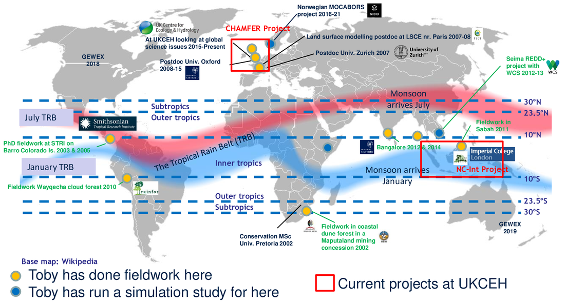
   I'm a cross-over scientist, half fieldworker and half modeller. I've done enough fieldwork to understand that field experience is essential for real understanding of ecosystems, but I've also done enough modelling to understand that there is critical understanding of large-scale events that can only come from looking at the wider scale.

   Models like JULES are very widely-used nowadays and underpin predictions referred to and used by policymakers (e.g. through the IPCC). I am involved in the work of ensuring that we get the very best predictions out of these models that we can.
Land Surface Science group, UK Centre for Ecology & Hydrology (UKCEH),
MacLean Bdg, Wallingford OX10 8BB, U.K.
, tobmar *a,t* ceh *dot* ac *dot* uk
Proudly powered by Weebly
  • Home
  • Opportunities
  • Projects
    • CHAMFER
    • NC-Int-SEAsia
    • TES-NbS
    • TISE
    • Previous projects >
      • Hydro-JULES
      • MOCABORS >
        • MOGEN
      • CSSP Brazil
      • Projects pre-2021
  • Publications
  • Map-based CV
  • Resources
    • Menu of MODEL runs
    • Menu of COURSES
    • Spatial Data >
      • GISbasics
      • GISpackages
      • 1D2D
      • Animate data
    • JULES Ancils >
      • HSAncils
    • JULES on JASMIN
    • Gather
    • Wytham Maps
  • Gallery
  • SIGOPAM
  • Welcome to UKCEH